
Search Term Record
Metadata
Name |
Blue Lake |
Number of Photo records |
8 |
Related Records
-
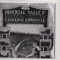
Magazine titled: Imperial Valley, Second Annual Magazine Edition, Calexico Chronicle. Published by Otis B. Tout. Note: This is a photocopy, use it for research.
Magazine
Record Type: Library
-
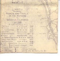
A1985.113.3 - Map
Map. Reproduction / blueprint type map Showing Roads And Trails Of The Pioneers To San Diego, California 1768-1865. Shows the route from Yuma Arizona to San Diego.
Record Type: Archive
-
-
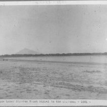
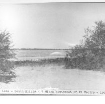
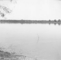
P2003.48.1 - Print, Photographic
Blue Lake, South of Silsbee, 7 miles southwest of El Centro - 1901.
Record Type: Photo
-
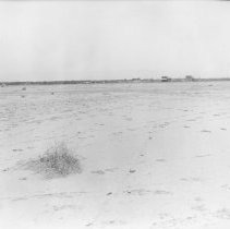
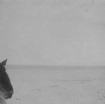
P2007.22.5a - Print, Photographic
Six photos on one page. Upper left caption reads "An unusual mirage on desert near Blue Lake is S.W. part of Valley" - looks like a lone bush growing in the desert. Photos taken on an excursion to the valley.
Record Type: Photo
-
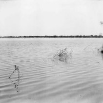
P2007.5.76 - Print, Photographic
H-49 - Blue Lake, taken from foot of Main Street in the townsite of Silsbee, looking northwest.
Record Type: Photo
-
P2007.5.77 - Print, Photographic
H-50 - Blue Lake, taken from the Boulevard at the townsite of Silsbee, looking southwest.
Record Type: Photo
-
P2007.5.78 - Print, Photographic
H-51 - Silsbee Townsite, with Business Center and Mesquite Forest surrounding Blue Lake as a Background." Bare desert in the foreground, a few wooden buildings in the distance, and some bushes in the far distance.
Record Type: Photo